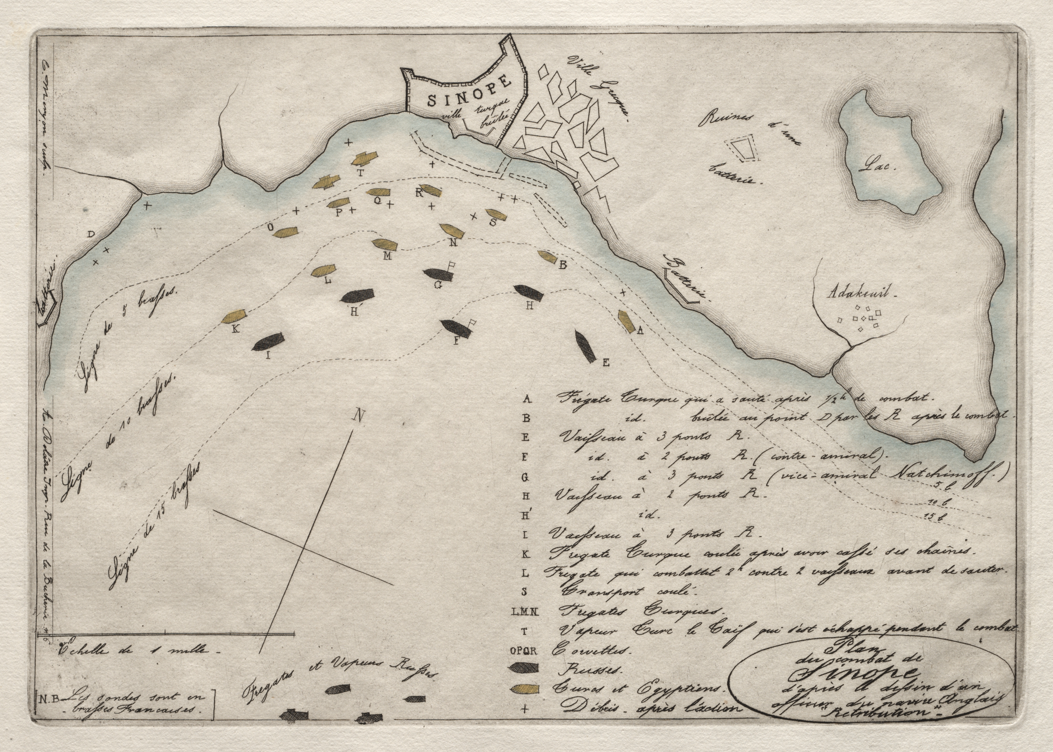
Map titled "SINOPE" showing a coastline with bodies of water and land. A peninsula with a city or town labeled "SINOPE" is at top center. There are various symbols and markings throughout, including ships and boats on the water, labeled with letters. A key or legend on the bottom right explains the symbols. A compass with a long line extending from it is on the left. The map has a thin black border around the edges. The background of the map is beige with blue areas representing water. Handwritten text in French is throughout the map.
Artwork details
- Dimensions:
- 1250 × 893 px
- Museum record:
- View original
You May Also Like

Plan du Combat de Sinope (Plan of the Battle of Sinope)

The Siege of La Rochelle: Plate 12

The Siege of La Rochelle: Plate 11

Plate 72 from The Plan of Chicago, 1909: Chicago. Sketch Diagram of Docks Suggested at the Mouth of the Calumet River for Bulk Freight Steamers; Access To Be Had Without Opening of Bridges.

View of Venice

Map of Region Northwest of Mount Tacoma (from Sketchbook)

The Siege of La Rochelle: Plate 5

College Henri IV

Chart and Plan of the Harbour of New York

The Siege of La Rochelle: Plate 10

View of Lewenberg

View from the Viaduct at the Pont-du-Jour, Panorama de la Seine

View of Venice

A Selection of Twenty of the Most Picturesque Views in Paris: View of Belle Vue & Pont de Sêve

The Siege of La Rochelle: Plate 6

Egypt and Nubia, Volume III: Map to Illustrate the Sketches of David Roberts, Esq: R.A. in Egypt and Nubia 1849

The Siege of La Rochelle: Plate 7

A mapp of ye improved part of Pensilvania in America, divided into countyes, townships and lotts

View from the Battery toward the City

Fortress in a Lake

Map of the Grand Canal from Beijing to the Yangzi River

Entrance to the Faubourg, Saint-Marceau, Paris

The Large Miseries of War: The Battle

View of Dresden