
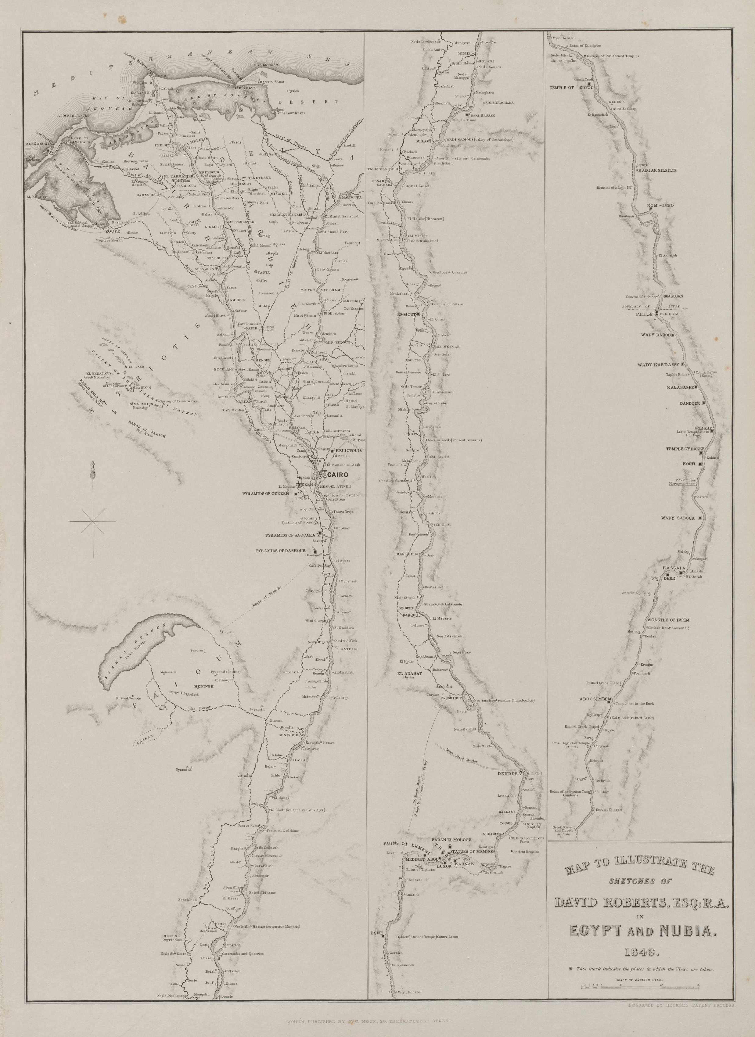
Egypt and Nubia, Volume III: Map to Illustrate the Sketches of David Roberts, Esq: R.A. in Egypt and Nubia 1849
Map with a thin black border on aged off-white background. The map is divided into three vertical sections. Left section depicts a river delta at the top with a compass rose. The central section shows a detailed map with numerous labeled locations and lines. The right section represents a river and its banks with labeled points. A text box on the bottom right reads: "MAP TO ILLUSTRATE THE SKETCHES OF DAVID ROBERTS, ESQ.R.A. IN EGYPT AND NUBIA. 1849". Small illegible text appears along the bottom edge. The overall appearance is sepia-toned with darker shading around geographical features.
Artwork details
- Dimensions:
- 650 × 893 px
- Museum record:
- View original
You May Also Like

Chart and Plan of the Harbour of New York

The Siege of La Rochelle: Plate 5

Map of the Battle of Sinope

Map of Region Northwest of Mount Tacoma (from Sketchbook)

The Siege of La Rochelle: Plate 12

The Siege of La Rochelle: Plate 10

Illustrations of Famous Places in China

The Siege of La Rochelle: Plate 6

College Henri IV

Map of the Western Hemisphere (from Sketchbook)

The Siege of La Rochelle: Plate 7

Road Map of Central Europe

The Siege of La Rochelle: Plate 11

Plate 72 from The Plan of Chicago, 1909: Chicago. Sketch Diagram of Docks Suggested at the Mouth of the Calumet River for Bulk Freight Steamers; Access To Be Had Without Opening of Bridges.

A mapp of ye improved part of Pensilvania in America, divided into countyes, townships and lotts

Plan du Combat de Sinope (Plan of the Battle of Sinope)

View of Venice

Map of the Province of New York

Embroidered Map Sampler

Seine Fishing off Charcoal Burner's Point, Akaroa

Charing Cross Railway-Bridge

Sampler

View of Lewenberg

Saint James's Park