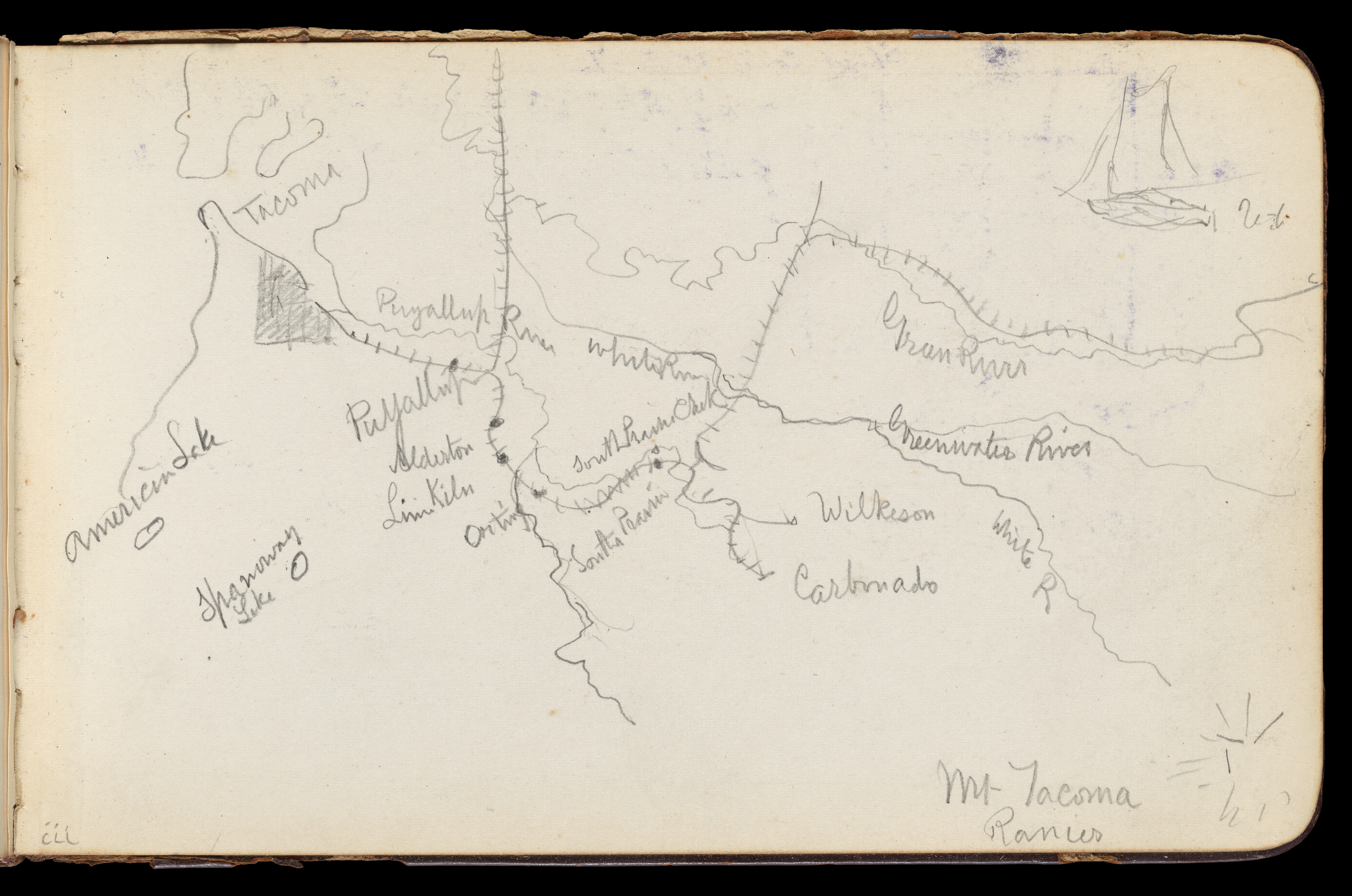
Map of Region Northwest of Mount Tacoma (from Sketchbook)
A hand-drawn map on off-white paper with dark brown lines and black writing. The map shows a region northwest of a mountain labeled "Mt. Tacoma." The map features several rivers, including the Puyallup River, labeled rivers include the Puyallup, South Fork, and Green River, and the Quinault River. Other labels include "American Fork", "Haggerty", "Tacoma", and place names such as "Wilkinson", and "Carbonado." A shaded rectangular area and a simple sailboat sketch are present. The paper has a black background.
Artwork details
- Date:
- 1890
- Medium:
- Graphite on wove paper
- Culture:
- American
- Dimensions:
- 599 × 397 px
- Museum record:
- View original
You May Also Like

Map of the Battle of Sinope

Chart and Plan of the Harbour of New York

Egypt and Nubia, Volume III: Map to Illustrate the Sketches of David Roberts, Esq: R.A. in Egypt and Nubia 1849

The Siege of La Rochelle: Plate 7

Embroidered Map Sampler

College Henri IV

Charing Cross Railway-Bridge

Plate 72 from The Plan of Chicago, 1909: Chicago. Sketch Diagram of Docks Suggested at the Mouth of the Calumet River for Bulk Freight Steamers; Access To Be Had Without Opening of Bridges.

Saint James's Park

The Siege of La Rochelle: Plate 12

The Siege of La Rochelle: Plate 6

Album of Daoist and Buddhist Themes: Search the Mountain: Leaf 46

Plan du Combat de Sinope (Plan of the Battle of Sinope)

Album with Views of Rome and Surroundings, Landscape Studies, page 20b: "Cervera"

A Selection of Twenty of the Most Picturesque Views in Paris: View of Belle Vue & Pont de Sêve

Sampler

Bastion 49

Sketchbook- The Granite Shore Hotel, Rockport, page 182: Sailboat with color notations

The Siege of La Rochelle: Plate 5

The Siege of La Rochelle: Plate 11

Ruins Overlooking River with Bridge

English War Work: Munition Town

A Selection of Twenty of the Most Picturesque Views in Paris: View from Palace Terrace at St. Germain-en-Laye, the Aqueduct of Marli seen in the Distance

Entrance to the Faubourg, Saint-Marceau, Paris


