
Sampler
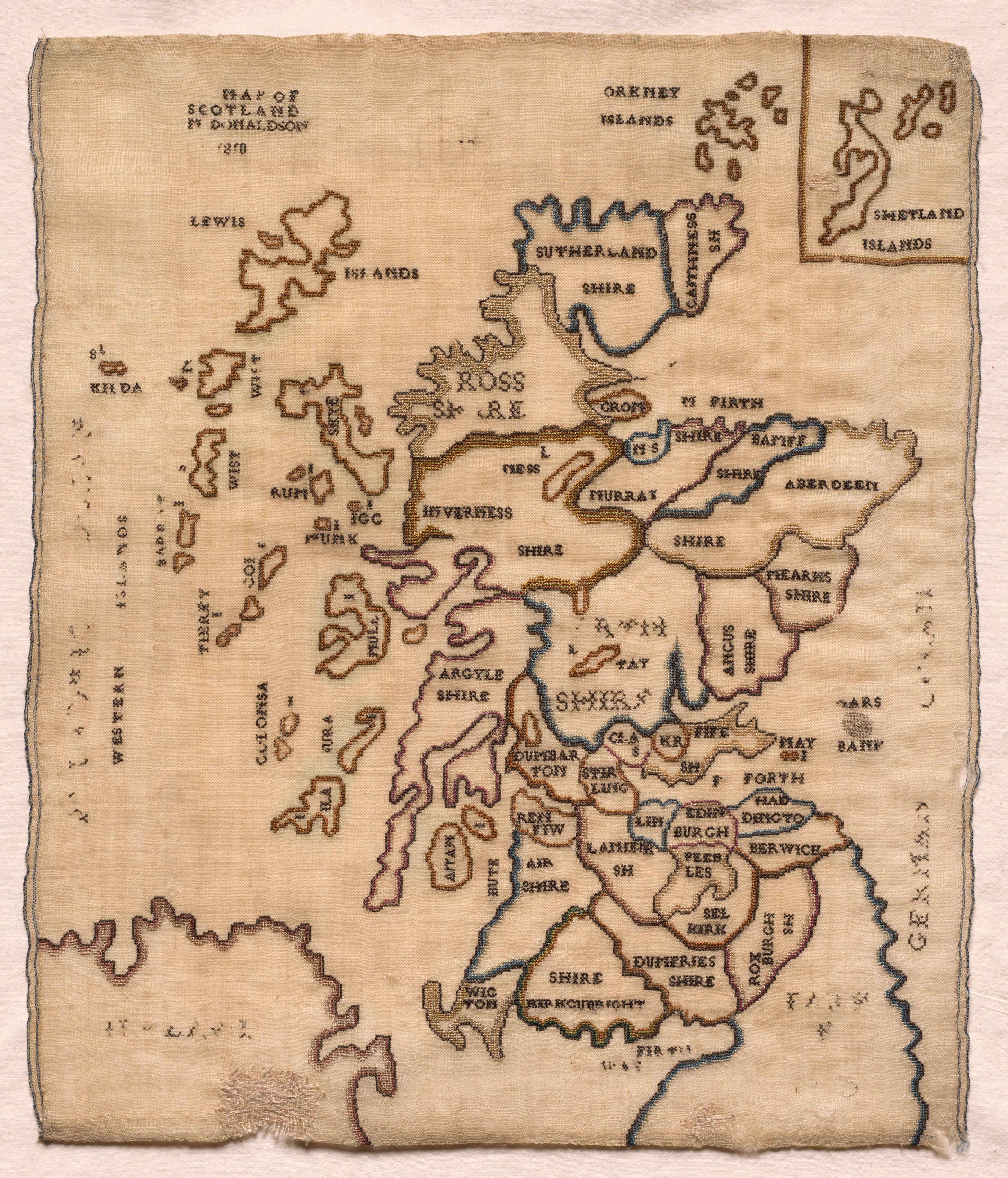
Tan fabric with a stitched map of Scotland. The map is titled "MAP OF SCOTLAND BY DONALDSON 1810". The map features various regions, including Lewis, Sutherland Shire, Ross & Cromarty, Inverness Shire, Argyll Shire, and the Shetland Islands. The map has a blue stitched border around the edges. A smaller inset map in the top-right corner shows the Shetland Islands. The fabric has a rough, handmade appearance with frayed edges. The background of the image is white. The map "Sampler".
Artwork details
- Dimensions:
- 771 × 900 px
- Museum record:
- View original
You May Also Like

The Siege of La Rochelle: Plate 6

Sampler

Road Map of Central Europe

The Siege of La Rochelle: Plate 5

Album of Daoist and Buddhist Themes: Procession of Daoist Deities: Leaf 3

Map of the Battle of Sinope

Illustrations of Famous Places in China

The Siege of La Rochelle: Plate 7

Chart and Plan of the Harbour of New York

The Siege of La Rochelle: Plate 11

Map of Region Northwest of Mount Tacoma (from Sketchbook)

View of Venice

Forts Zeelandia and Provintia and the City of Tainan

Peter of Poitiers's "Compendium Historiae in Genealogia Christi" (pair)

Peter of Poitiers's "Compendium Historiae in Genealogia Christi"

Peter of Poitiers's "Compendium Historiae in Genealogia Christi"

The Gotha Missal: Fol. 13r, Text

The Gotha Missal: Fol. 12v, Text

The Siege of La Rochelle: Plate 10

The Gotha Missal: Fol. 92r, Text

The Gotha Missal: Fol. 91v, Text

Saint James's Park

Text, folio 3 (recto), from a Gospel Book with Commentaries

The Gotha Missal: Fol. 100v, Text