
Sampler
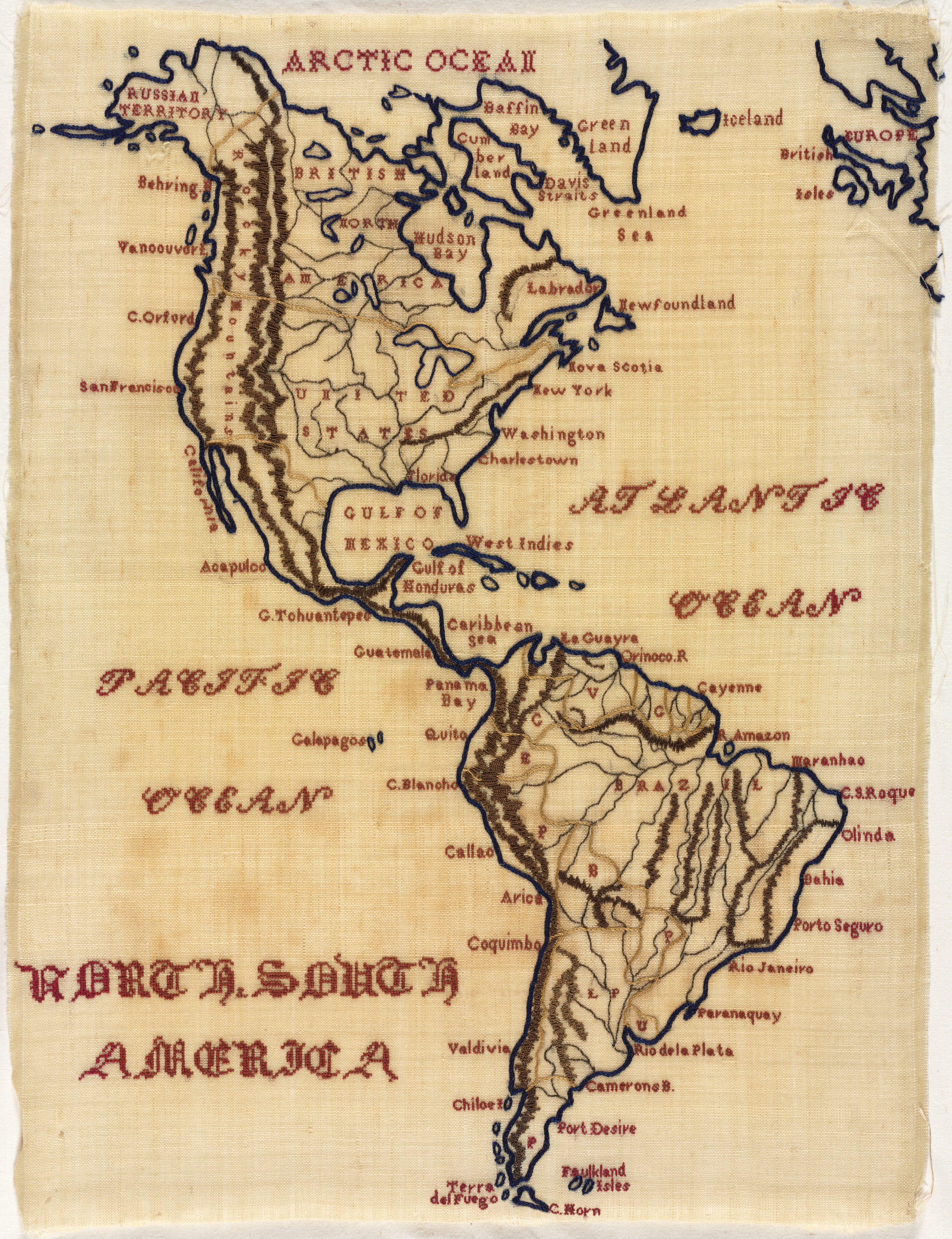
Beige-colored fabric with a stitched map of North and South America. The map is stitched in dark blue and brown thread, with place names in red thread. The map includes the Arctic Ocean, Atlantic Ocean, and Pacific Ocean, with their names stitched in red thread. North America is at the top, with the United States, Canada, and Mexico labeled. South America is at the bottom, with country names and geographical features labeled. The words "North and South America" are stitched in red thread below South America. The map appears to be hand-stitched, with visible fabric weave and stitching. The image is a map titled "Sampler". The artist is not visually identified.
Artwork details
- Dimensions:
- 686 × 893 px
- Museum record:
- View original
You May Also Like

Sampler

Map of the Western Hemisphere (from Sketchbook)

Map of North America (Handkerchief)

Road Map of Central Europe

The Siege of La Rochelle: Plate 6

Map of the Battle of Sinope

A mapp of ye improved part of Pensilvania in America, divided into countyes, townships and lotts

Album of Daoist and Buddhist Themes: Procession of Daoist Deities: Leaf 3

The Siege of La Rochelle: Plate 11

Sampler

Text, folio 3 (recto), from a Gospel Book with Commentaries

Three Heads and Other Sketches (verso)

Map of Region Northwest of Mount Tacoma (from Sketchbook)

View of Venice

Plan du Combat de Sinope (Plan of the Battle of Sinope)

Map of Southern New England

The Siege of La Rochelle: Plate 5

View of Venice

Piece

Illustrations of Famous Places in China

Page from Ramayana

Egypt and Nubia, Volume III: Map to Illustrate the Sketches of David Roberts, Esq: R.A. in Egypt and Nubia 1849

Piece

Leaves from a Christian Homily