
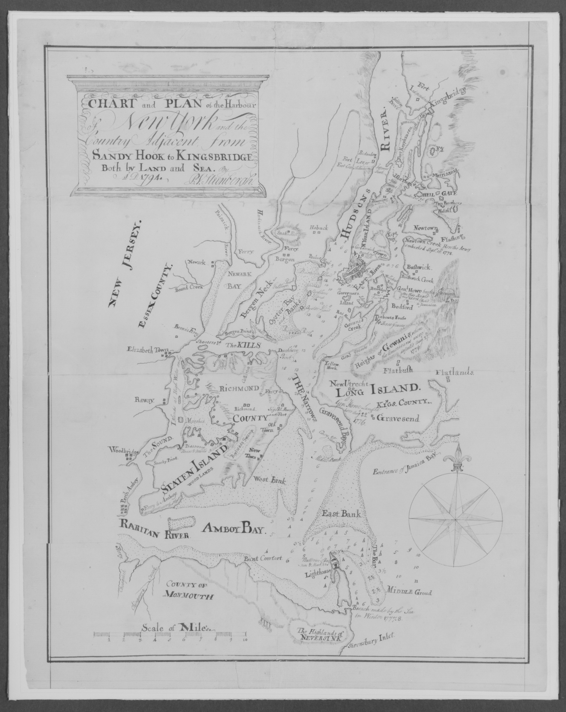
Black-and-white map with a thin border. Map displays a harbor with land on all sides. Top-left features a box with title text: "Chart and Plan of the Harbour of New York". Smaller text below title reads: "Comprehending the Country from Sandy Hook & Kingsbridge, Both by Land and Sea". Below map text reads: "Dated 1781". Map's focus on harbor with detailed coastline and a compass rose in the bottom-right. Land areas labeled with place names including: - New Jersey - Staten Island - Long Island - New York - Raritan River - Amboy Bay. A scale is marked as "Scale of Miles".
Artwork details
- Date:
- 1794
- Medium:
- Pen and iron-gall ink on off-white laid paper
- Culture:
- American
- Dimensions:
- 496 × 625 px
- Museum record:
- View original
You May Also Like

Egypt and Nubia, Volume III: Map to Illustrate the Sketches of David Roberts, Esq: R.A. in Egypt and Nubia 1849

Map of the Battle of Sinope

Map of Region Northwest of Mount Tacoma (from Sketchbook)

The Siege of La Rochelle: Plate 11

The Siege of La Rochelle: Plate 5

The Siege of La Rochelle: Plate 12

The Siege of La Rochelle: Plate 6

The Siege of La Rochelle: Plate 7

The Siege of La Rochelle: Plate 10

College Henri IV

Plan du Combat de Sinope (Plan of the Battle of Sinope)

Sampler

View of Venice

Plate 72 from The Plan of Chicago, 1909: Chicago. Sketch Diagram of Docks Suggested at the Mouth of the Calumet River for Bulk Freight Steamers; Access To Be Had Without Opening of Bridges.

Illustrations of Famous Places in China

Map of the Western Hemisphere (from Sketchbook)

Landscape with a Lake

View of Lewenberg

View of Venice

Receuil d'essais lithographiques: Essai topographique

A Selection of Twenty of the Most Picturesque Views in Paris: View of Belle Vue & Pont de Sêve

A mapp of ye improved part of Pensilvania in America, divided into countyes, townships and lotts

Seine Fishing off Charcoal Burner's Point, Akaroa

The Waterfall


