Embroidered Map Sampler
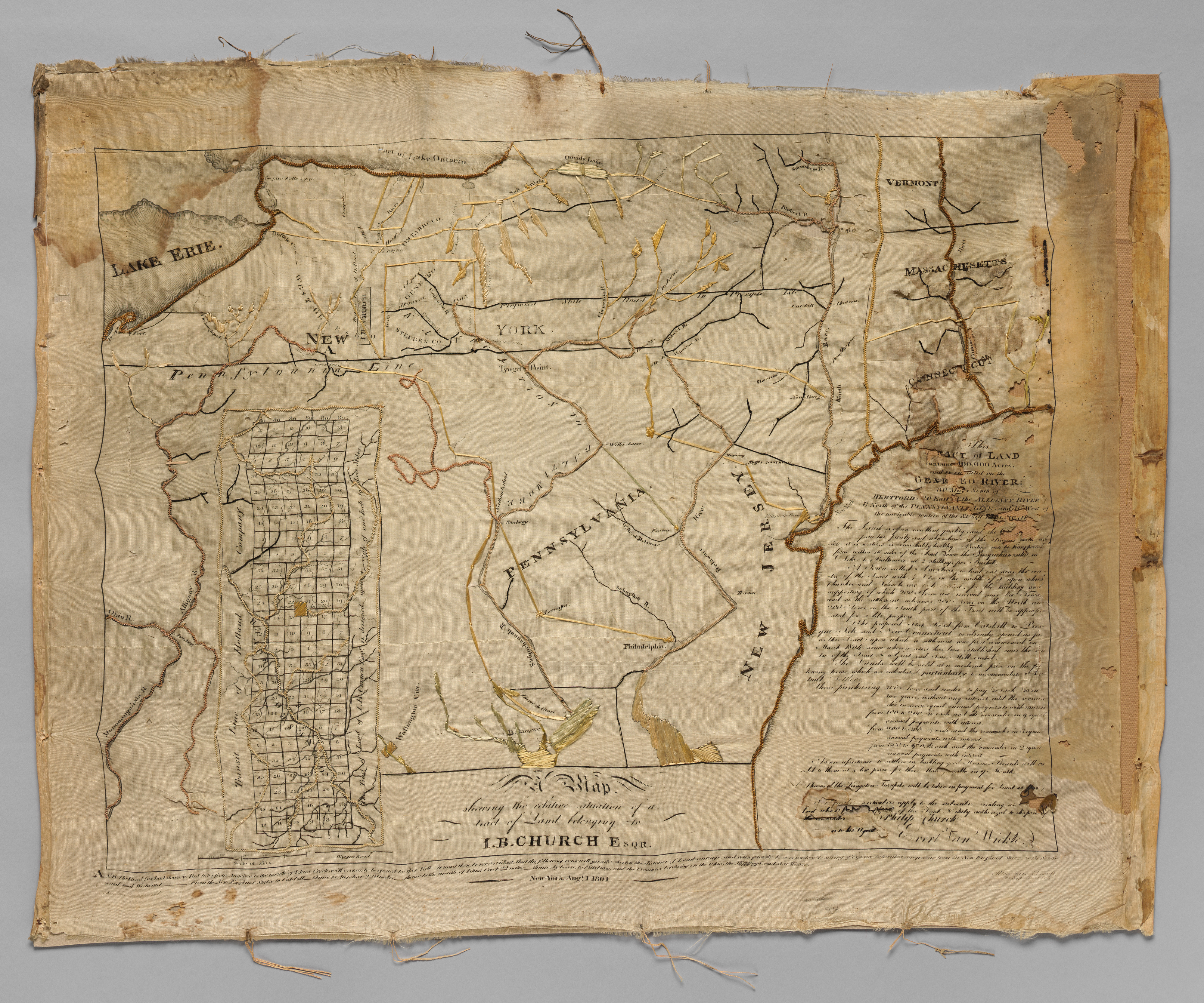
Embroidered Map Sampler by unidentified artist. The image shows a vintage, rectangular map on aged paper with a light brown color. The map depicts several regions with lines indicating roads and waterways. The top left shows 'Lake Erie' in black text. The top center shows 'York' in black text. The map has several labeled areas including 'Embroidered Map Sampler' at the bottom center. The bottom left shows a grid pattern. The right side contains a large block of illegible cursive text. The map's edges are frayed and torn in several places. The background behind the map is solid gray. The sampler displays several stitched elements, primarily with orange and yellow thread.
Artwork details
- Date:
- ca. 1810
- Medium:
- Silk embroidered with silk
- Culture:
- American
- Dimensions:
- 600 × 500 px
- Museum record:
- View original
You May Also Like

A mapp of ye improved part of Pensilvania in America, divided into countyes, townships and lotts

Map of Region Northwest of Mount Tacoma (from Sketchbook)

Map of the Battle of Sinope

Illustrations of Famous Places in China

Plate 72 from The Plan of Chicago, 1909: Chicago. Sketch Diagram of Docks Suggested at the Mouth of the Calumet River for Bulk Freight Steamers; Access To Be Had Without Opening of Bridges.

The Siege of La Rochelle: Plate 6

Egypt and Nubia, Volume III: Map to Illustrate the Sketches of David Roberts, Esq: R.A. in Egypt and Nubia 1849

Chart and Plan of the Harbour of New York

August: Landscape with Wagons

Plan du Combat de Sinope (Plan of the Battle of Sinope)

Landscape with the Village of Schenkenschanz, Gelderland

Map of the Province of New York

Road Map of Central Europe

College Henri IV

The Siege of La Rochelle: Plate 5

Siege of a Fortress: Left Portion

Sampler

The Siege of La Rochelle: Plate 12

Charing Cross Railway-Bridge

The Siege of La Rochelle: Plate 11

The Siege of La Rochelle: Plate 10

Farm with Trees in a Hilly Landscape

Saint James's Park

Text, folio 199 (recto), from a Gospel Book with Commentaries


